
World map labels and directions worksheets
Locate continents and oceans and compare map directions. These sheets use Oceania; discuss how that regional name differs from Australia in other continent models.
4 activities · Grade 1 to Grade 5
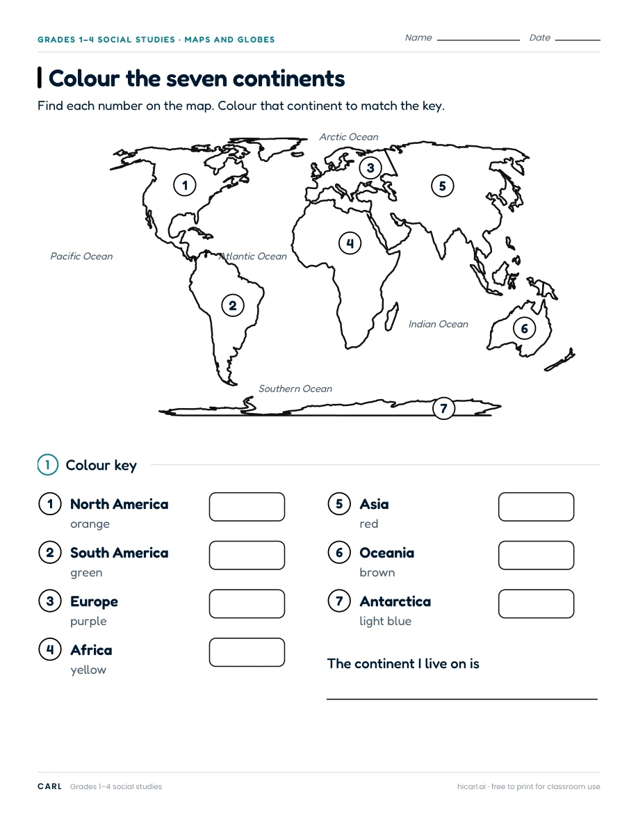
Colour the seven continents
This worksheet uses Oceania for Australia and neighbouring islands. Explain that many seven-continent models name Australia as the continent and Oceania as the wider region. Use written colour names if colouring is not accessible.
Link to this worksheet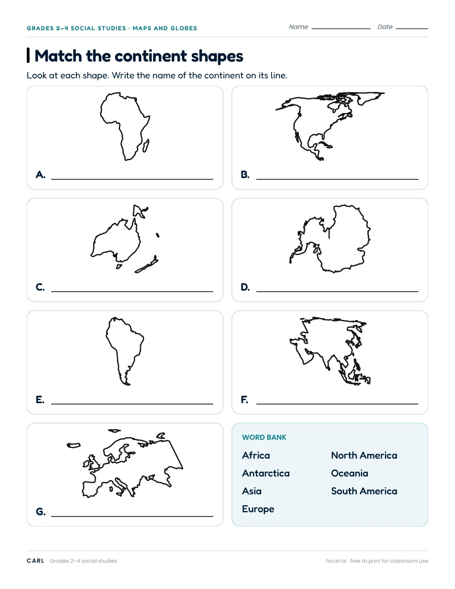
Match the continent shapes
This worksheet uses Oceania for Australia and neighbouring islands. Explain that many seven-continent models name Australia as the continent and Oceania as the wider region.
Link to this worksheet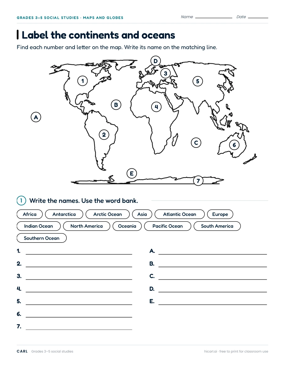
Label the continents and oceans
This worksheet uses Oceania for Australia and neighbouring islands. Explain that many seven-continent models name Australia as the continent and Oceania as the wider region.
Link to this worksheet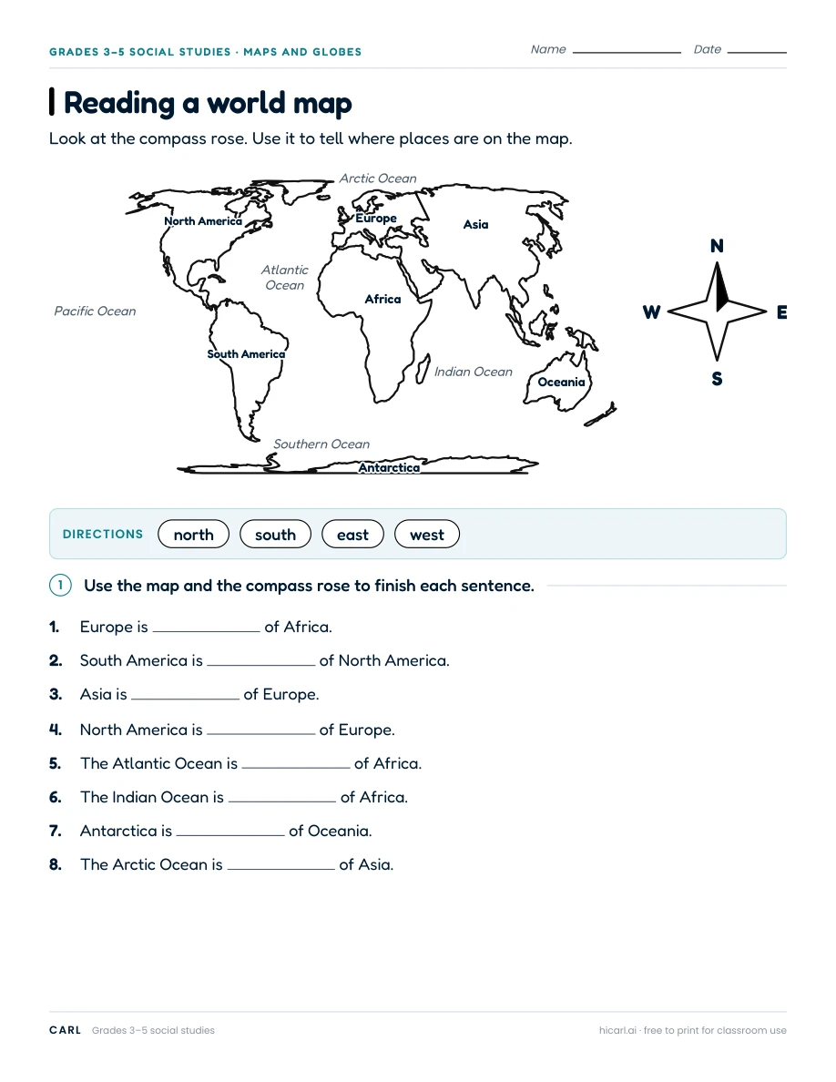
Reading a world map
This worksheet uses Oceania for Australia and neighbouring islands. Explain that many seven-continent models name Australia as the continent and Oceania as the wider region. Compare directions on the displayed flat map.
Link to this worksheet